Please note:
This article is for informational purposes only and does not constitute professional advice.
Always seek the guidance of a qualified expert for specific concerns.
This article is for informational purposes only and does not constitute professional advice.
Always seek the guidance of a qualified expert for specific concerns.
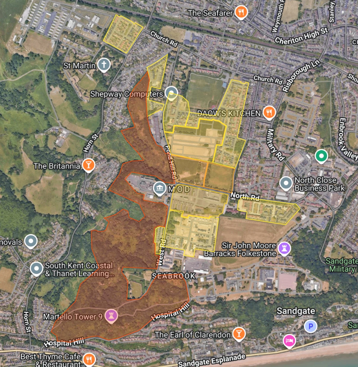
Our development is split into "phases" which are areas of the development. These phases are important as when they are handed over from Taylor Wimpey to First Port these areas are referenced in the budgets and accounts to help you identify what you are paying for.
We have created a useful map to help you identify where each phase is.
Current Phases:
- Phase 1A
St Martins plain estate phase areas, Horn Street (partial), Ghale Way, Wheeler Drive, Allmand Drive - Phase 1B
The Stadium estate phase areas, Aldridge Road, The Rifles, The Lancers, The Guards, The Rangers, Burgoyne Way, Garrison Close, Dura Way, Kunway Ave 1B (partial), Dargoon Place (partial), Risborough Lines - Phase 1C
Primary School Site - Phase 1D
Skye Close,
Cheriton Court Road (partial)
Neptune Drive - Phase 1E
Le Quesne - Phase 2A
Major Close, Officers Mess, Brigadier & Lieutenant Court - Phase 2B
Somerset Barracks, Rosenburg Place, Blunden Drive, Brooke Road, Binyon Grove, Owen Road, Ledwidge Road - Phase 2C
Burgoyne Square, Lofthouse Drive, Ellis Grove, Nearne Way, Moggridge Close, Appleton Road, Cavell Place, Wind Mews - Phase 2D
The Nursery (Sapper Row) - Phase 3
Risbourough Barracks - Phase 4
Napier Barracks